
Quick Answer: A warm front forms where warm air advances over retreating cold air — producing a gradual, shallow slope, wide cloud sequences, and prolonged precipitation ahead of the surface front. A cold front forms where cold air advances and undercuts warm air — producing a steep slope, narrow but intense weather, and a rapid clearing after passage. Understanding both, and the occlusion that forms when they merge, is essential for the EASA Meteorology exam and for every real-world flight planning decision you will make.
Table of Contents
- What Is an Air Mass and Why Do Fronts Form?
- The Warm Front
- The Cold Front
- The Warm Sector
- Occlusions: Cold and Warm
- Side-by-Side Comparison Table
- EASA Exam Traps — What the Question Bank Tests
- Key Takeaways
- FAQ
- Conclusion
What Is an Air Mass and Why Do Fronts Form?
Before you can understand fronts, you need a clear picture of air masses — because a front is simply the boundary between two of them.
An air mass is a large body of air with broadly uniform temperature and humidity characteristics, acquired by sitting over a source region for days or weeks. A polar air mass that has sat over the North Atlantic is cold and moist. A tropical air mass from the Sahara is warm and dry. When these two bodies of air meet, they do not mix — they push against each other along a boundary called a front.
The shape and behaviour of that front — how steep it is, how fast it moves, what weather it generates — depends entirely on which air mass is advancing and which is retreating. That is the fundamental distinction between a warm front and a cold front.
The Warm Front
Structure and slope
A warm front forms when a warm air mass advances into a region occupied by colder, denser air. Because warm air is less dense, it cannot bulldoze the cold air out of the way — instead, it rides up and over the cold air along a very gentle inclined surface.
The slope of a warm front is typically around 1:150 — meaning for every 150 km of horizontal distance, the front rises only 1 km vertically. This shallow gradient has enormous consequences for the weather it produces and the distance over which that weather is spread.
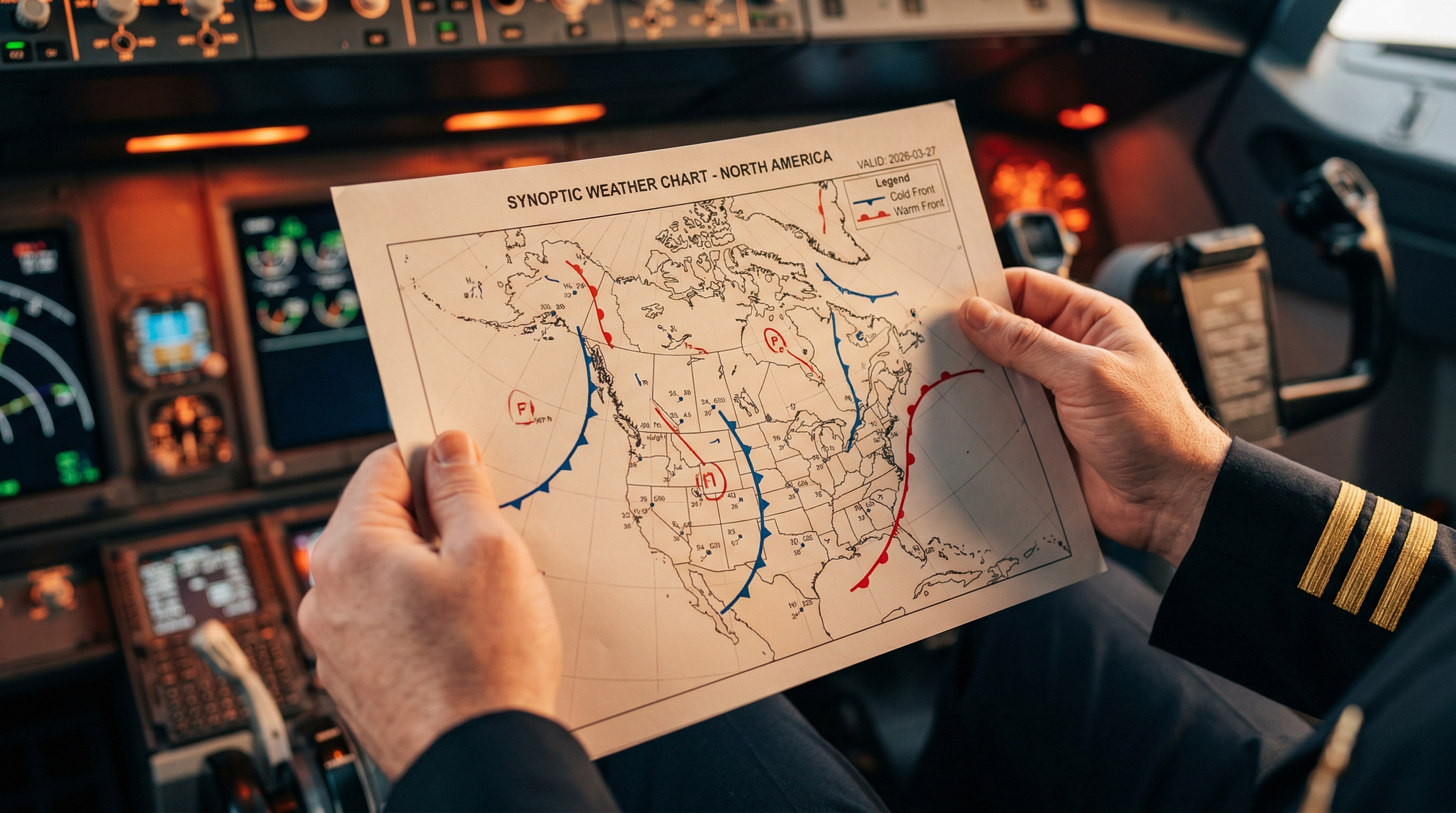
On a surface chart, a warm front is represented by a red line with red semicircles pointing in the direction of movement.
Cloud sequence
The shallow slope of the warm front means that different layers of cloud form at different altitudes along the frontal surface, spread over hundreds of kilometres ahead of the surface position. The classic sequence, encountered from a distance as the front approaches, is:
- Cirrus (Ci) — the first sign of an approaching warm front, appearing 600–900 km ahead of the surface front as thin, wispy high-level cloud
- Cirrostratus (Cs) — a thin veil of high cloud that produces the characteristic halo around the sun or moon; roughly 400–600 km ahead
- Altostratus (As) — a thicker grey or blue-grey sheet of cloud; the sun becomes a watery disk; 200–300 km ahead
- Nimbostratus (Ns) — the main precipitation cloud; continuous, moderate to heavy rain or snow; begins 100–200 km ahead of the surface front
- Stratus (St) — low, featureless cloud, often in the warm sector behind the surface front
Exam tip: EASA regularly tests the cloud sequence order. Memorise it as Ci → Cs → As → Ns → St. Also know that the widest precipitation zone is associated with the warm front — a common exam question.
Weather before, during and after passage
Before passage:
- Pressure: steadily falling
- Wind: southerly or south-easterly, veering as the front approaches
- Temperature: cool
- Visibility: deteriorating, eventually poor in rain and low cloud
- Cloud: the sequence above, building from Ci down to Ns
- Precipitation: prolonged, continuous rain or snow beginning 200–300 km ahead
At and during passage:
- Pressure: stops falling, briefly steadies
- Wind: veers — typically from SE to SW in the Northern Hemisphere
- Temperature: rises noticeably as the warm sector arrives
- Visibility: poor in rain, may briefly improve after the front passes
- Precipitation: rain eases or stops
After passage (in the warm sector):
- Pressure: quasi-steady or very slowly falling
- Wind: southwesterly, steady
- Temperature: warm
- Cloud: low stratus or stratocumulus, possible drizzle
- Visibility: often poor in haze, mist or drizzle — deceptively benign-looking
Icing and turbulence hazards
The warm front produces some of the most operationally significant icing conditions in the ATPL syllabus. The key mechanism is freezing rain.
Where the warm air aloft is above 0°C but the cold air below remains sub-zero, rain falling from the warm layer passes through the sub-zero air near the surface and becomes supercooled. When these supercooled droplets hit the airframe, they freeze instantly — forming clear (glaze) ice, the most hazardous form of airframe icing.
The freezing level in the warm air is typically around 8,000–10,000 ft; in the cold air ahead of the surface front it may be as low as 2,000 ft. The worst icing zone is between these two levels — in the cold air beneath the frontal surface where the rain is falling.
Exam tip: A classic EASA question: 'If the freezing level in the warm air is at 10,000 ft and at 2,000 ft in the cold air, at what altitude is freezing rain most likely?' Answer: between 2,000 ft and 10,000 ft — specifically in the cold air, below the 10,000 ft freezing level. The highest risk is just below the 10,000 ft level where the droplets have just entered the sub-zero zone.
Turbulence associated with warm fronts is generally moderate and spread over a wide area. It is linked to wind shear at the frontal surface and to embedded cumulonimbus that can form if the warm air is unstable. The latter — frontal thunderstorms embedded in layered cloud — are particularly hazardous because they are invisible on the pilot's visual scan and may only be detectable on weather radar.
The Cold Front
Structure and slope
A cold front forms when a cold air mass advances and undercuts the warmer air ahead of it. Cold air is denser — it pushes under the warm air and forces it to rise sharply and rapidly. The result is a much steeper frontal surface than the warm front.
The slope of a cold front is typically around 1:50 to 1:100 — two to three times steeper than a warm front. This steep slope compresses the weather into a much narrower zone, producing more intense but shorter-lived conditions.
On a surface chart, a cold front is represented by a blue line with blue triangles pointing in the direction of movement. Cold fronts typically move faster than warm fronts — often 25–35 knots compared to 15–20 knots for a warm front.
Cloud sequence
Because the cold front slope is steep and the forced ascent is rapid, cumuliform cloud dominates rather than the stratiform layers seen with the warm front. The cloud sequence is very different:
- Altocumulus (Ac) — often the first sign; may appear as altocumulus castellanus ahead of the front, indicating instability
- Cumulonimbus (Cb) — the dominant cloud at the front itself; can extend from low levels to the tropopause
- Cumulus (Cu) — large convective cumulus in the cold air mass behind the front, often producing heavy showers
The total width of cloud and precipitation associated with a cold front is typically 50–100 km — compared to 200–300 km for the warm front. What it lacks in extent it compensates for in intensity.
Weather before, during and after passage
Before passage:
- Pressure: falling, sometimes rapidly
- Wind: south-westerly, increasing
- Temperature: warm (in the warm sector)
- Visibility: moderate to good
- Cloud: Ac/Cb building rapidly on the horizon
- Precipitation: heavy rain, hail, or thunderstorms approaching quickly
At and during passage:
- Pressure: rapid drop then sharp rise — a trough of low pressure sits along the front
- Wind: sudden, dramatic veer — typically from SW to NW in the Northern Hemisphere; gusty and squally
- Temperature: sharp, rapid drop
- Visibility: very poor in heavy rain or hail, then suddenly very good after the front clears
- Precipitation: heavy rain, possible hail, thunderstorms; short duration
After passage:
- Pressure: rising quickly
- Wind: north-westerly, gusty
- Temperature: noticeably colder
- Cloud: large cumulus and cumulonimbus showers — classic cold air mass instability
- Visibility: excellent between showers — a sharp visual contrast with the warm sector
Exam tip: The pressure trace during cold front passage is a favourite EASA question: the altimeter reading first increases (pressure drops as the trough approaches), then decreases (pressure rises sharply as the cold air arrives). Know this sequence precisely.
Icing and turbulence hazards
The cold front is one of the most turbulent environments a pilot can encounter. The rapid forced ascent of warm moist air produces vigorous cumulonimbus — and within a Cb, turbulence can be severe to extreme at all levels.
Icing within cold frontal Cb clouds is severe. Large supercooled water droplets in cumuliform cloud produce rapid clear ice accretion. Hail is also possible, which presents a structural risk and can block pitot systems if encountered unexpectedly.
The wind shear on either side of the cold front is intense — particularly the low-level wind shear near the surface, which is a significant hazard on approach and departure. The sudden veer and gust on front passage can produce a dangerous loss of airspeed at low altitude.
Operational note: Never attempt to fly through a cold frontal Cb. Circumnavigate by at least 20 nm. If the front is a continuous line of Cb with no gaps, hold until it passes or divert. The cold front's narrow width means it often moves through a given location within 30–60 minutes — holding is frequently the safest option.
The Warm Sector
The warm sector is the region of warm, moist air that sits between the warm front (ahead) and the cold front (behind) within a mid-latitude depression. On a surface chart it is labelled with the letter C in some conventions, and bounded by the two frontal lines.
The warm sector often looks deceptively benign from a pilot's perspective. The sky may be overcast with low stratus or stratocumulus, drizzle may be falling, and there are no dramatic convective features. But several hazards exist:
- Radiation fog is impossible in the warm sector — the sky is cloudy. But hill fog and advection fog are common when moist warm air flows over cooler land or sea surfaces
- Visibility is often poor despite the absence of heavy precipitation — haze, mist, and drizzle reduce forward visibility significantly, sometimes below minima
- Low cloud bases — stratus bases in the warm sector can be below 500 ft, making VFR flight impossible and IFR approaches demanding
- Embedded Cb — if the warm sector air is unstable (maritime tropical air especially), cumulonimbus can be hidden within the stratiform cloud layer and undetectable without weather radar
Occlusions: Cold and Warm
An occlusion forms when the cold front — which moves faster than the warm front — catches up with the warm front and lifts the warm sector air off the ground entirely. The two fronts merge at the surface, and the warm air is pushed aloft.
On a surface chart, an occlusion is shown as a purple line with alternating semicircles and triangles.
There are two types of occlusion, and EASA tests the distinction precisely:
Cold occlusion
The air behind the cold front is colder than the air ahead of the warm front. The advancing cold air undercuts both the warm sector air and the cool air ahead of the warm front, lifting everything. The surface weather resembles a cold front — rapid change, cumuliform cloud, good visibility after passage.
Exam trap: EASA asks 'What is signified if an occlusion is described as cold?' Answer: the air behind the cold front is colder than the air ahead of the warm front. This is one of the most commonly tested occlusion questions in the question bank.
Warm occlusion
The air ahead of the warm front is colder than the air behind the cold front. The cold front air rides up over the cooler air ahead of the warm front. The surface weather resembles a warm front — gradual change, stratiform cloud, prolonged precipitation.
In both cases, the occlusion concentrates the weather of both fronts into a single zone and is often the most complex and hazardous region of the entire depression system — with combined icing, turbulence, and precipitation hazards.
Side-by-Side Comparison Table
This table summarises the key characteristics the EASA exam tests most frequently. Memorise every row.
| Characteristic | Warm Front | Cold Front |
|---|---|---|
| Advancing air mass | Warm air advances over cold | Cold air advances under warm |
| Frontal slope | Shallow ~1:150 | Steep ~1:50 to 1:100 |
| Speed of movement | Slow (15–20 kt) | Fast (25–35 kt) |
| Cloud types | Ci → Cs → As → Ns → St | Ac → Cb → Cu (post-frontal) |
| Precipitation type | Continuous, prolonged rain/snow | Heavy showers, hail, thunderstorms |
| Precipitation zone width | 200–300 km ahead of surface | 50–100 km wide |
| Visibility | Poor, deteriorates gradually | Very poor at front, excellent after |
| Wind change at passage | Veers gradually (SE → SW) | Sudden veer (SW → NW), squally |
| Temperature change | Gradual rise after passage | Sharp, rapid drop after passage |
| Pressure trace | Steady fall then steadies | Fall then sharp rise at passage |
| Turbulence | Moderate, widespread | Severe to extreme in Cb |
| Main icing hazard | Freezing rain below warm layer | Severe icing in Cb, hail possible |
| Chart symbol | Red line, red semicircles | Blue line, blue triangles |
EASA Exam Traps — What the Question Bank Tests
The EASA Meteorology exam does not simply ask you to define a warm front. It constructs scenarios that test whether you truly understand the mechanisms. These are the most common question patterns:
The altimeter during cold front passage
The altimeter first shows an increase (pressure falling in the frontal trough) then a decrease (pressure rising sharply as the cold air arrives). Do not confuse the direction — this is a classic trick question.
The widest precipitation zone
Ahead of a warm front — not during or after. The prolonged precipitation extends 200–300 km ahead of the surface front. Cold fronts have narrower but more intense precipitation bands.
Freezing rain altitude
Freezing rain occurs in the cold air beneath the warm layer, between the cold air freezing level (e.g. 2,000 ft) and the warm air freezing level (e.g. 10,000 ft). The most dangerous altitude is just below the warm air's 0°C isotherm — not at the surface.
Cold vs warm occlusion
'Cold' means the air behind the cold front is colder than the air ahead of the warm front. 'Warm' means the reverse. This definition trips up many candidates because 'cold occlusion' sounds like it should mean the air in front is colder — it doesn't.
The warm sector on the surface chart
EASA sometimes shows a synoptic chart and asks which region is the warm sector. It is the region between the warm front (ahead) and the cold front (behind). On the chart it is labelled with a 'C' in some formats.
Wind direction change on warm front passage
The wind veers on passage of both fronts in the Northern Hemisphere — but the manner is different. Warm front: gradual veer from SE to SW. Cold front: sudden veer from SW to NW with squalls. In the Southern Hemisphere, winds back rather than veer.
Cloud type associated with jet streams
Cirrus and cirrostratus form along the jet stream axis, which typically lies above and just ahead of the warm front. Lenticular cloud is associated with mountain waves — a different phenomenon entirely.
Key Takeaways
- A warm front has a shallow slope (~1:150), wide cloud and precipitation coverage, and gradual weather changes over hundreds of kilometres.
- A cold front has a steep slope (~1:50), narrow but intense weather, and rapid — sometimes violent — changes at passage.
- The classic warm front cloud sequence is Ci → Cs → As → Ns → St. Memorise this order — EASA tests it directly.
- Freezing rain under a warm front is the most hazardous icing scenario: supercooled rain in the cold air beneath the frontal surface, worst between the two freezing levels.
- A cold occlusion means the air behind the cold front is colder than the air ahead of the warm front — not the other way around.
- The altimeter during cold front passage first increases (pressure trough), then decreases sharply (cold air arrival). This is a guaranteed exam question.
- The warm sector can look benign but contains poor visibility, low cloud, advection fog risk, and the possibility of embedded Cb in unstable conditions.
- ClearATPL's adaptive quiz engine at clearatpl.com covers the full EASA Meteorology question bank — including all the front-related traps above.
FAQ
Why does the warm front slope matter for the exam?
The slope determines the horizontal extent of the weather. The shallow 1:150 warm front slope means cloud and precipitation are spread over 200–300 km ahead of the surface position. The steeper 1:50 cold front compresses everything into 50–100 km. EASA tests this by asking about precipitation zone width, cloud distances, and the time available for a pilot to react to approaching weather.
What is the difference between a front and a trough?
A front is the boundary between two distinct air masses of different temperature and humidity. A trough is an elongated area of low pressure — it may or may not have a frontal boundary associated with it. Cold fronts sit within troughs, which is why the pressure drops sharply on approach and rises rapidly after passage.
Why does the wind veer on frontal passage in the Northern Hemisphere?
Wind veering — clockwise rotation of wind direction — occurs because of the temperature gradient reversal across the front. As warm air replaces cold air (warm front passage) or cold air replaces warm air (cold front passage), the pressure distribution changes, rotating the geostrophic wind clockwise. In the Southern Hemisphere, the Coriolis effect is reversed, so winds back (rotate anticlockwise) on frontal passage.
What is the jet stream's relationship to fronts?
The polar front jet stream is found at the tropopause level, directly above and slightly ahead of the surface warm front position. It is generated by the strong temperature gradient between polar and tropical air masses. Jet stream turbulence — clear air turbulence (CAT) — is therefore most likely in the vicinity of the warm front at high altitudes.
Can cumulonimbus be embedded in a warm front?
Yes — this is the most operationally dangerous warm front scenario. If the warm sector air is convectively unstable (common with maritime tropical air), Cb can develop embedded within the stratiform Ns cloud. These embedded Cb are invisible to the naked eye and undetectable without weather radar. Moderate to severe turbulence and severe icing can be encountered without visual warning.
How fast does a cold front typically move compared to a warm front?
A cold front typically moves at 25–35 knots. A warm front moves at 15–20 knots. Because the cold front moves faster, it inevitably catches the warm front, lifting the warm sector off the ground and forming the occlusion. This is the natural lifecycle of a mid-latitude depression.
Conclusion
Warm fronts and cold fronts are not just exam topics — they are the dominant weather systems affecting European airspace, and understanding them at a mechanistic level is one of the most transferable things you will learn in your entire ATPL course.
The candidate who understands why a warm front produces freezing rain at mid-levels — not just that it does — will get the correct answer on every variant EASA can construct around that concept. The same applies to the altimeter trace, the occlusion types, and the cloud sequences. Mechanism first, memorisation second.
Meteorology is one of the subjects where the question bank alone is not enough. EASA constructs scenario-based questions that test understanding, and candidates who have only memorised answers to specific questions get caught out by small variations in wording or context. Study the physics, then use the bank to test and refine.
ClearATPL (clearatpl.com) covers all 13 ATPL subjects including the full Meteorology question set, with adaptive quizzing that targets the topics you are weakest on — including the frontal weather questions that catch the most candidates out.